
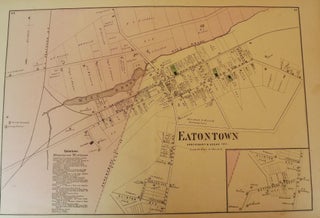
EATONTOWN, NEW JERSEY: 1873 MAP
1873. [F.W. BEERS ATLAS OF MONMOUTH COUNTY]. EATONTOWN MAP, 1873. A 13-inch by 24-inch hand-colored map of Eatontown showing, Shrewsbury and Ocean Township. $75.00. More

1873. [F.W. BEERS ATLAS OF MONMOUTH COUNTY]. EATONTOWN MAP, 1873. A 13-inch by 24-inch hand-colored map of Eatontown showing, Shrewsbury and Ocean Township. $75.00. More
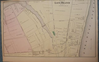
1873. [F.W. BEERS ATLAS OF MONMOUTH COUNTY]. LONG BRANCH, 1873 MAP. A 13-inch by 24-inch hand-colored map of a portion of Long Branch. $85.00. More
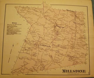
1873. [F.W. BEERS ATLAS OF MONMOUTH COUNTY]. MILLSTONE TOWNSHIP MAP, 1873. A 16-inch by 13-inch hand-colored map of Millstone. $75.00. More
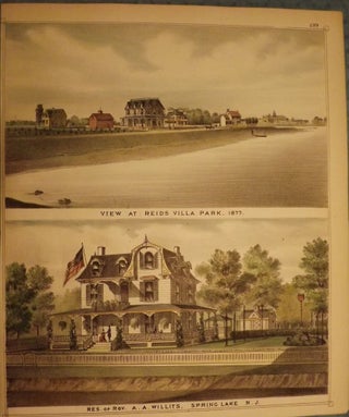
1877. [F.W. BEERS ATLAS OF MONMOUTH COUNTY]. SPRING LAKE, 1877: REIDS VILLA PARK.. Upper picture frontal view of Reids Villa Park, lower picture frontal view of the residence of Rev. A.A. Willits, Spring Lake. Hand-colored. $125.00. More