


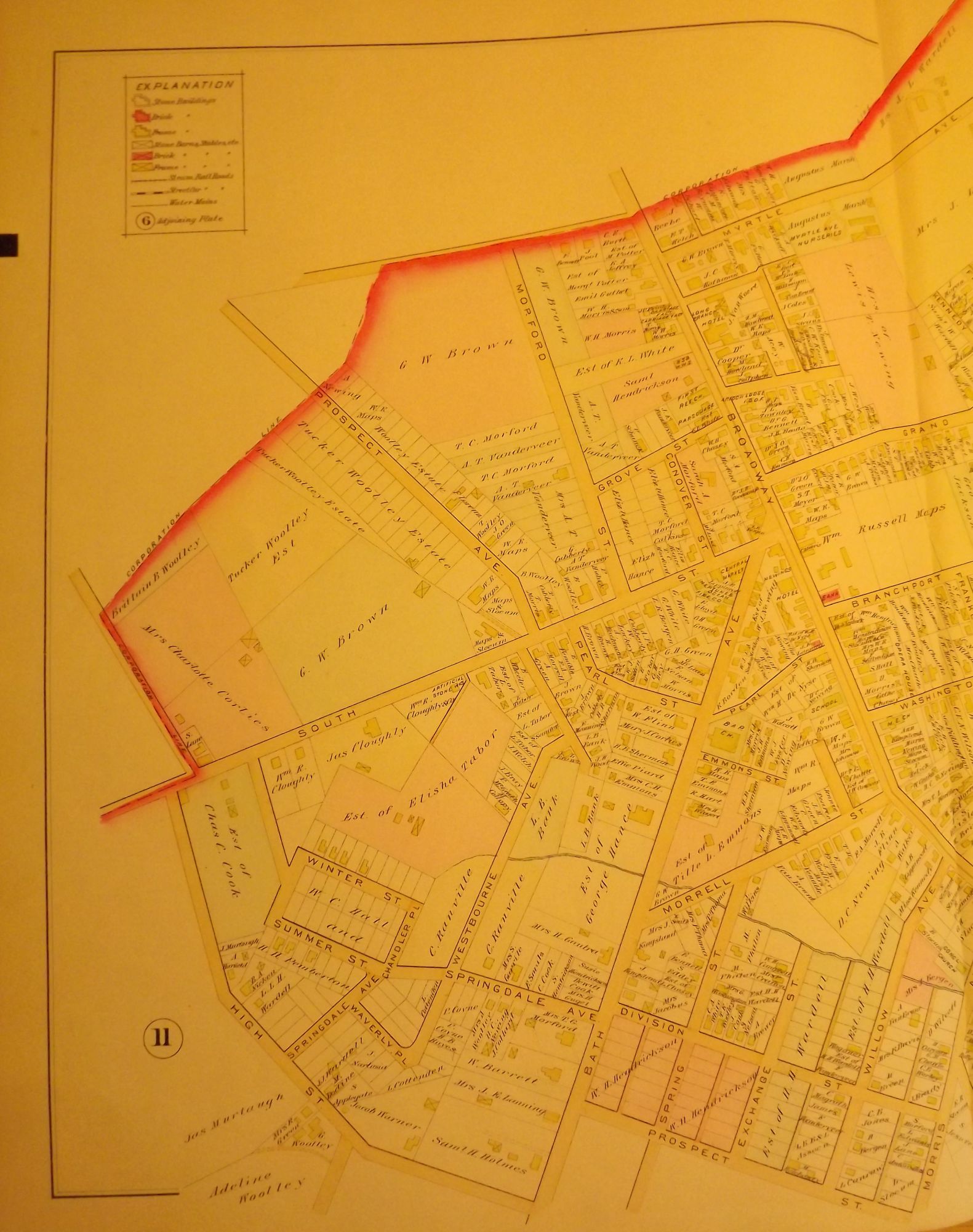
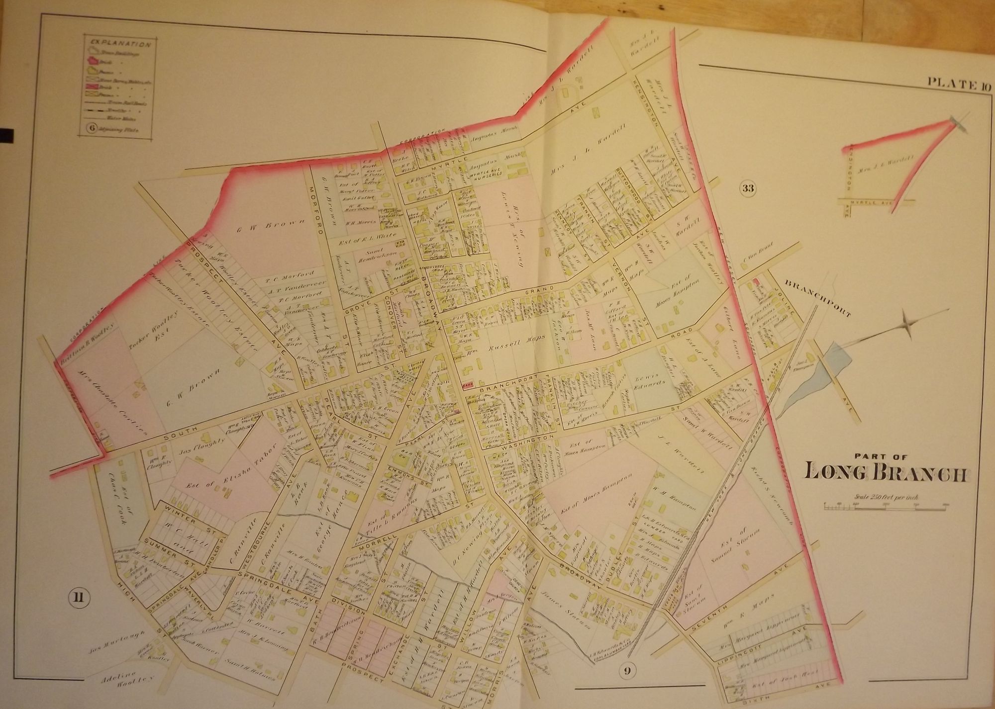
PART OF LONG BRANCH NJ MAP. FROM WOLVERTON'S “ATLAS OF MONMOUTH COUNTY,” 1889.
NY: Chester Wolverton, 1889. An original 30-inch by 22-inch linen-backed color map published in 1889. Map depicts Long Branch from High Street & Sixth Avenue to Myrtle Avenue; and from High Street to Joline Avenue. Shows types of structures erected at the time. The original hand-colored map (Plate 10), not a reproduction! Wolverton maps are among the best you can get of Monmouth County.
Very Good. Item #56909
Very Good.
Price: $150.00
See all items in
NJMAP
See all items by Chester WOLVERTON