

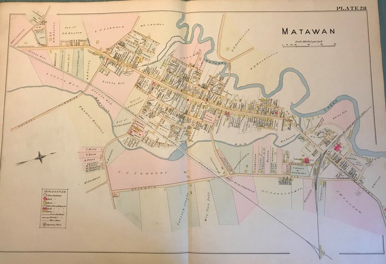
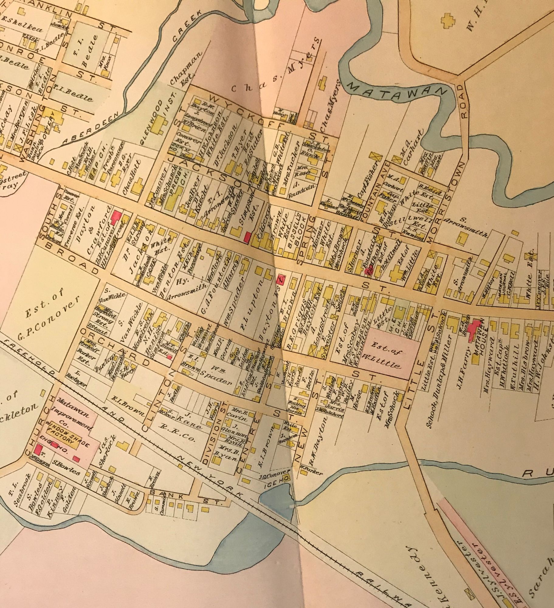
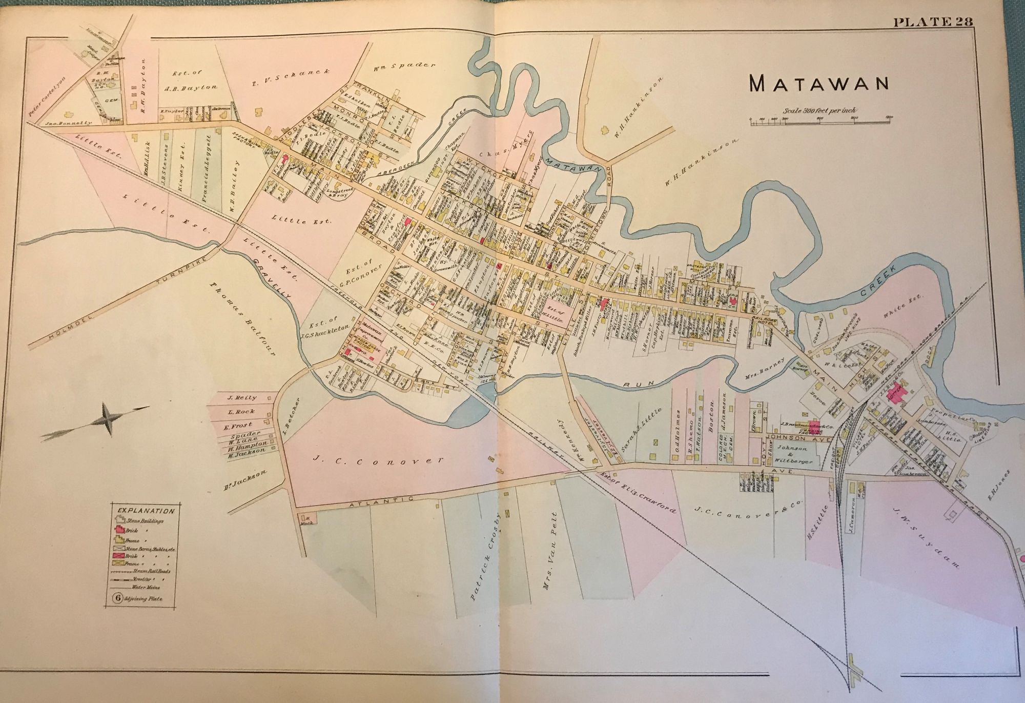
MATAWAN MAP, 1889
NY: Chester Wolverton, 1889. An original 30-inch by 22-inch linen-backed color map published in 1889. Map depicts Matawan. From Atlantic Avenue to the Matawan Creek; and from the railroad depot area to the Holmdel Turnpike area. Includes downtown areas. The original hand-colored map (Plate 28), not a reproduction! Wolverton maps are among the best you can get of Monmouth County. Very Good. Item #57117
Very Good condition.
Price: $150.00
See all items in
NJMAP
See all items by Chester WOLVERTON