

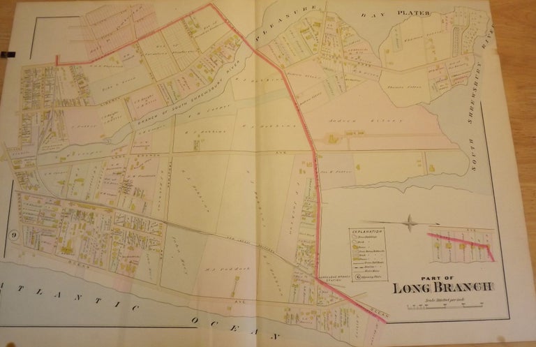
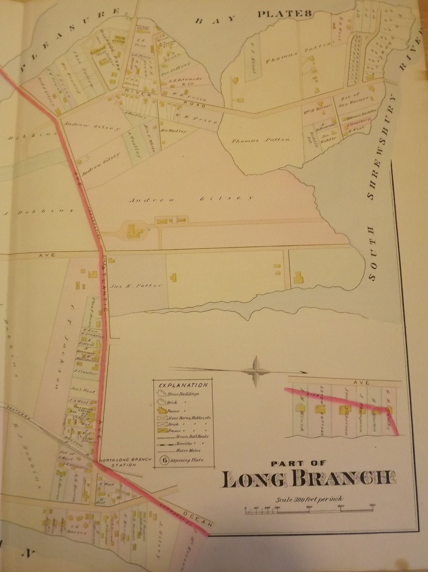
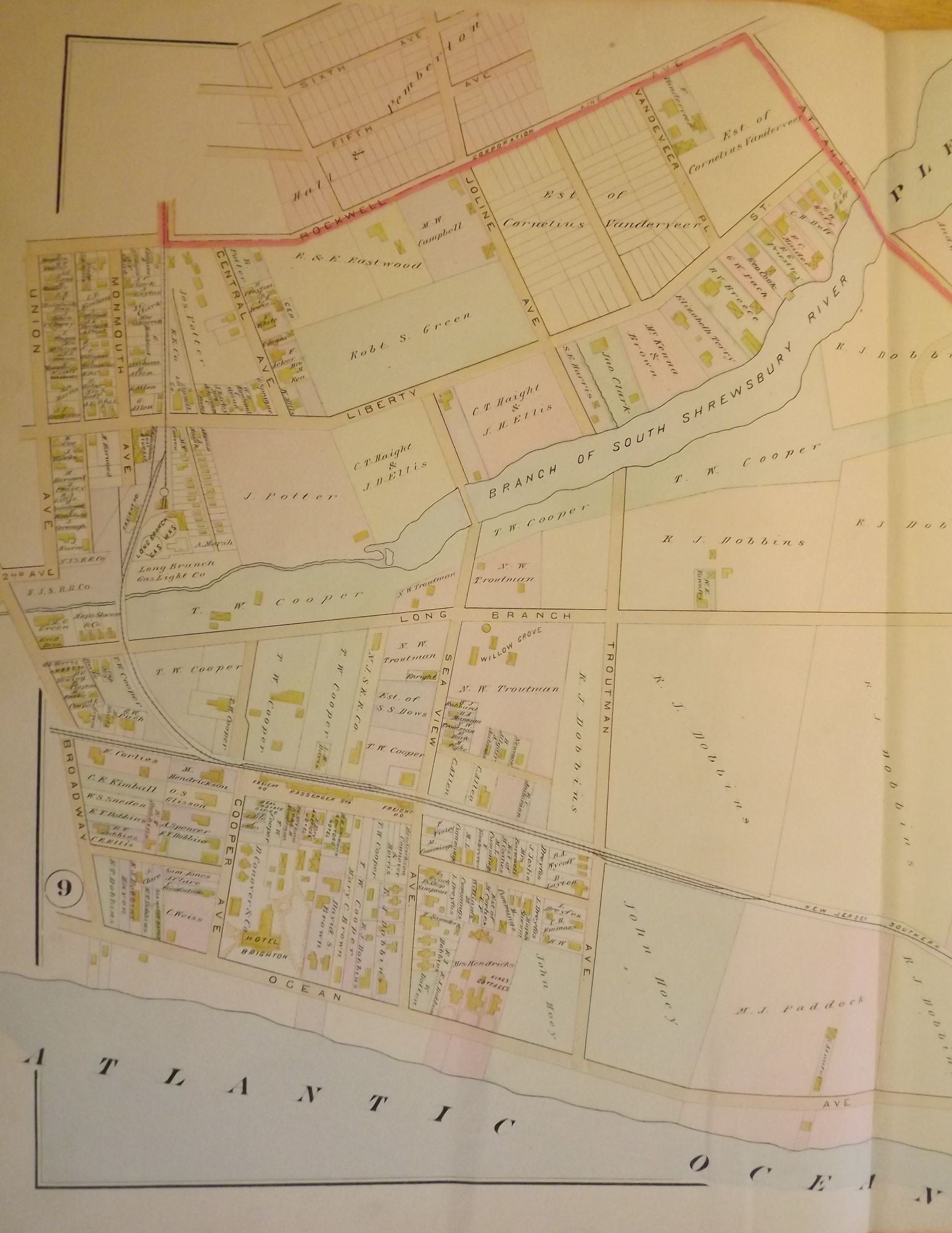
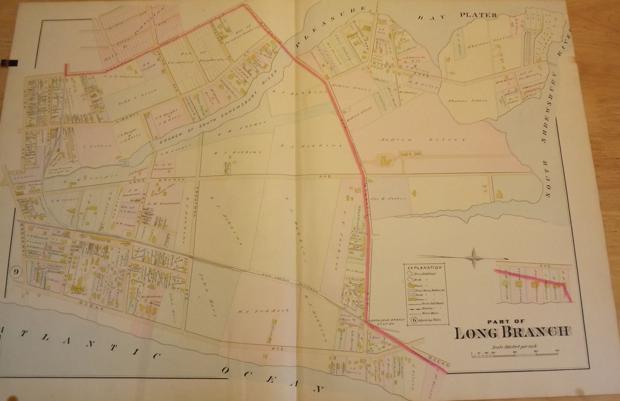
PART OF LONG BRANCH NJ MAP. FROM WOLVERTON'S “ATLAS OF MONMOUTH COUNTY,” 1889.
NY: Chester Wolverton, 1889. An original 30-inch by 22-inch linen-backed color map published in 1889. Map depicts Long Branch from the Atlantic Ocean to Pleasure Bay and from Broadway to the South Shrewsbury River. Shows types of structures erected at the time. The original hand-colored map (Plate 8), not a reproduction! Wolverton maps are among the best you can get of Monmouth County.
Very Good. Item #56908
Very Good.
Price: $150.00
See all items in
NJMAP
See all items by Chester WOLVERTON