

BERGEN COUNTY: WASHINGTON TOWNSHIP, HOHOKUS, PARK RIDGE, WESTWOOD MAP
1876. Item #51312
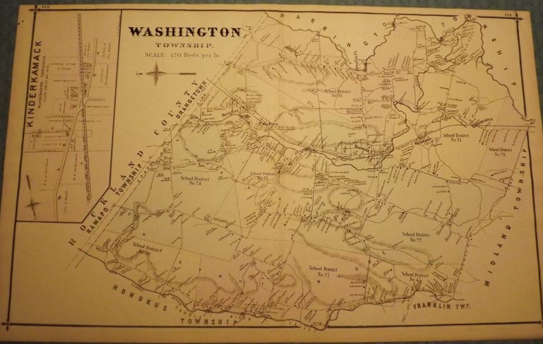
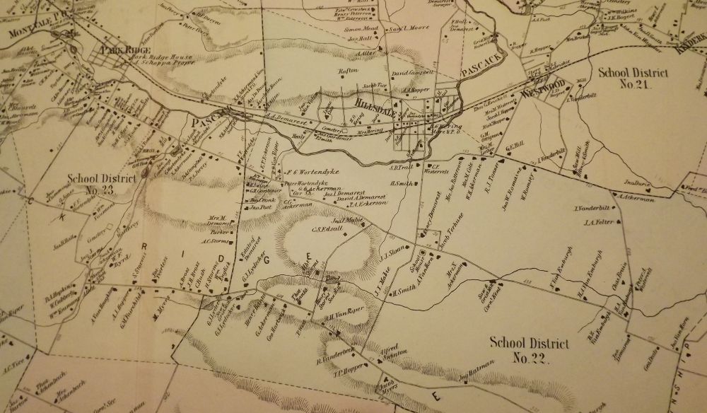
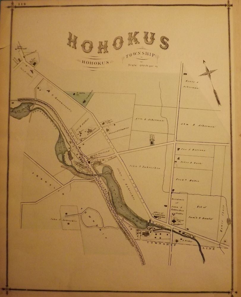
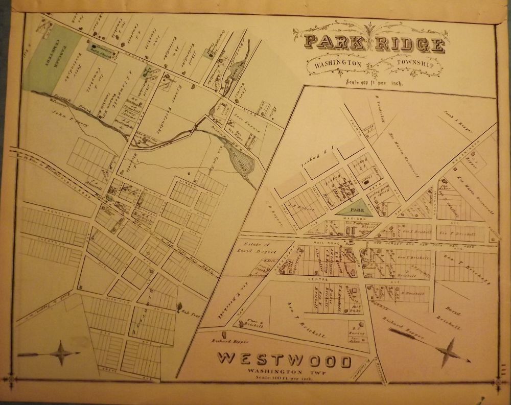
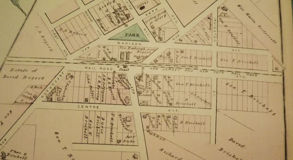
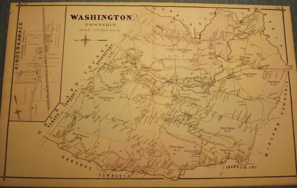
PEASE, C.C. BERGEN COUNTY: WASHINGTON TOWNSHIP, HOHOKUS, PARK RIDGE, AND WESTWOOD 1876 MAP. Two small maps and one large map from 1876. A large, hand-colored, fold-out map from the original "Atlas of Bergen County" published in Reading, Pennsylvania by C.C. Pease in 1876. One side is comprised of a 27.5-inch by 17-inch, hand-colored map of Washington Township from Rockland County to south Midland Township and Hohokus Township east to Harrinton Township. This map also has an inset featuring Kinderkamack near Locust Avenue. The other side has two smaller hand-colored maps: one features a 14.5-inch by 17-inch map of Hohokus from Sylvan Lake north while the other side features a 14.5-inch by 17-inch map divided into two sections- one featuring Park Ridge from Pascack Road east to Grove Avenue, and the Pascack Cemetery north to the Mill Pond Area. The other portion features Westwood Jefferson Avenue north and Fourth Avenue east to two blocks beyond Centre Avenue. Very Good (few short tears in the margins). $150.00.
Price: $150.00