

BERGEN COUNTY: CRESSKILL 1876 MAP
1876. Item #51315
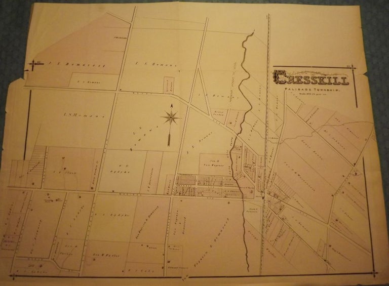
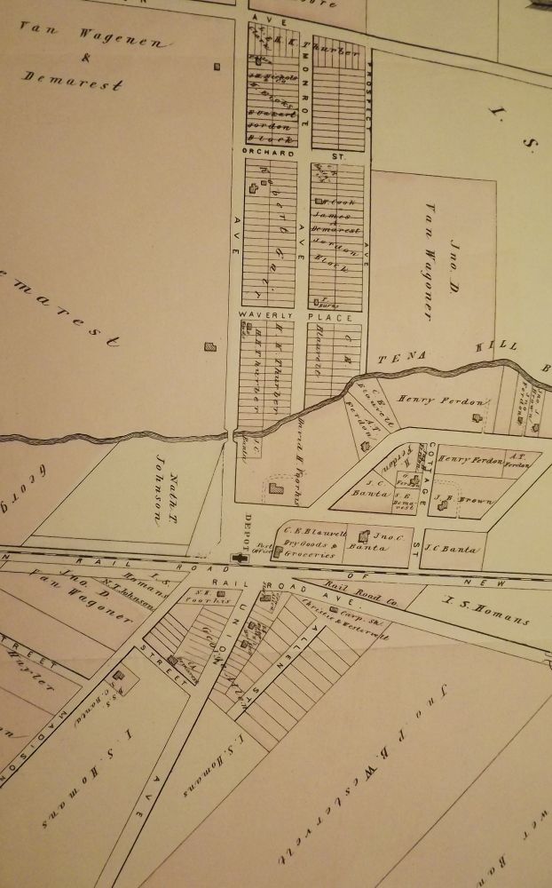
PEASE, C.C. BERGEN COUNTY: CRESSKILL 1876 MAP. A large, hand-colored, fold-out map from the original "Atlas of Bergen County" published in Reading, Pennsylvania by C.C. Pease in 1876. The map shows Cresskill, Palisade Township from Chestnut Avenue east to County Road and from Maple Street north to Grant Avenue. Map features the names of the property owners at the time. This large map measures 29 inches by 22 inches. Very Good (some edgewear & a few tears in the border). $150.00.
Price: $150.00
See all items in
NJMAP
See all items by C. C PEASE