

BERGEN COUNTY: PALISADES, PALISADES LAND COMPANY, HILLSDALE 1876 MAP
1876. Item #51316
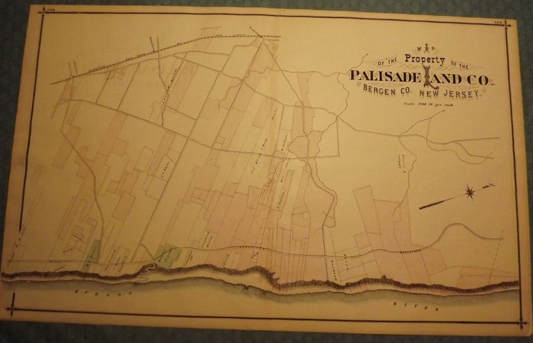
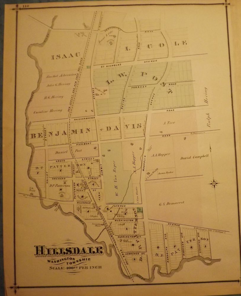
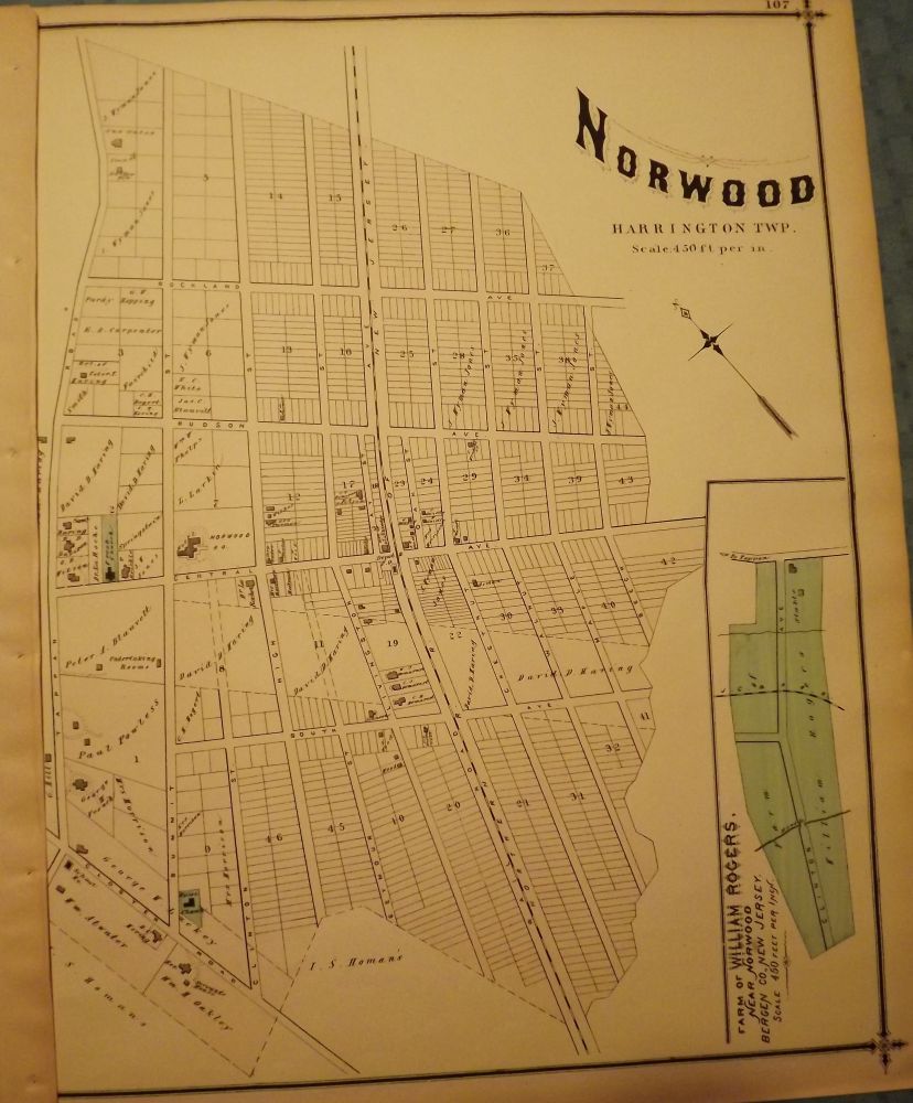
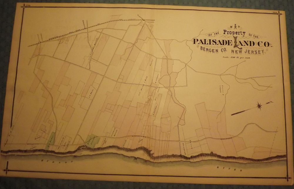
PEASE, C.C. BERGEN COUNTY: PALISADES, PALISADE LAND COMPANY, HILLSDALE AND NORWOOD 1876 MAP. Two small maps and one large map from 1876. A large, hand-colored, fold-out map from the original "Atlas of Bergen County" published in Reading, Pennsylvania by C.C. Pease in 1876. One side is comprised of a 27.5-inch by 17-inch hand-colored map of The Property owned by the Palisade Land Company, which is from the Hudson River west to the Northern Railroad of New Jersey. The other side has two smaller hand-colored maps: one features a 14.5-inch by 17-inch hand-colored map of Hillsdale in Washington Township from Pascack River east to just beyond Magnolia Avenue and Lawrence Street north to Serpentine Road while the other features a 14.5-inch by 17-inch, hand-colored map of Norwood, Harrington Township from Closter Road east to the 37th block on Rockland Avenue and Tappan Road south to Beech Street. This map also has a small inset featuring the farm of William Rogers near Norwood. Very Good. $135.00.
Price: $135.00