

BERGEN COUNTY: ENGLEWOOD 1876 MAP
1876. Item #51324
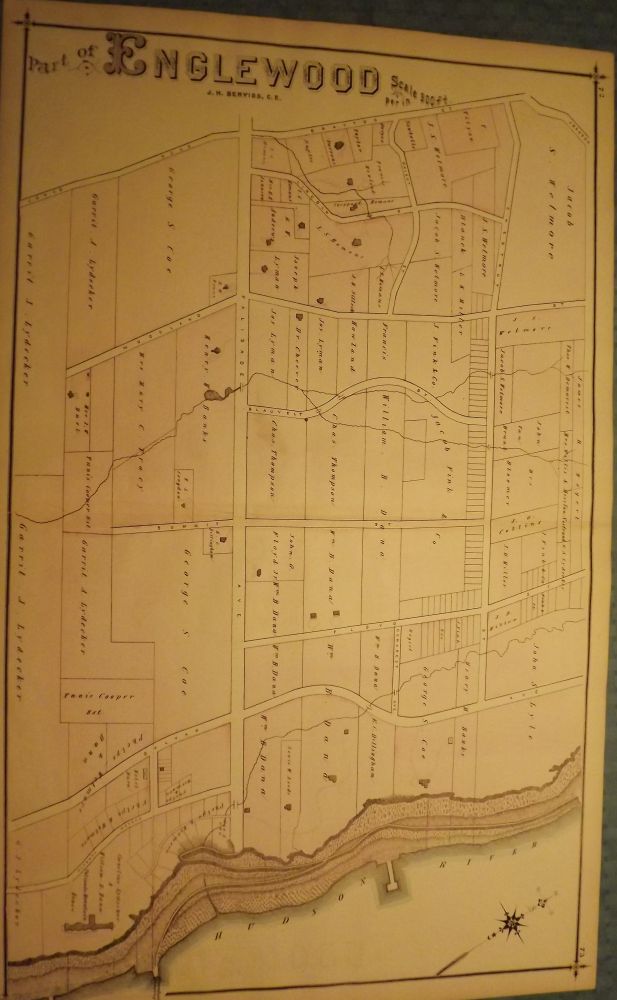
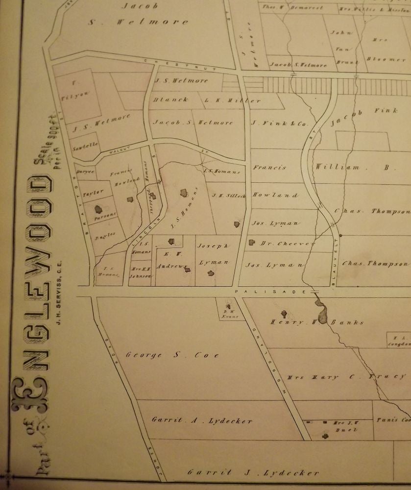
PEASE, C.C. BERGEN COUNTY: ENGLEWOOD 1876 MAP. A large, hand-colored, fold-out map from the original "Atlas of Bergen County" published in Reading, Pennsylvania by C.C. Pease in 1876. The map shows part of Englewood form the Hudson River west to Jones Road and just South of Palisade Avenue north to Johnson. Map features the names of the property owners at the time. This map measures 27.5 by 17 inches. Very Good. $125.00.
Price: $125.00
See all items in
NJMAP
See all items by C. C PEASE