

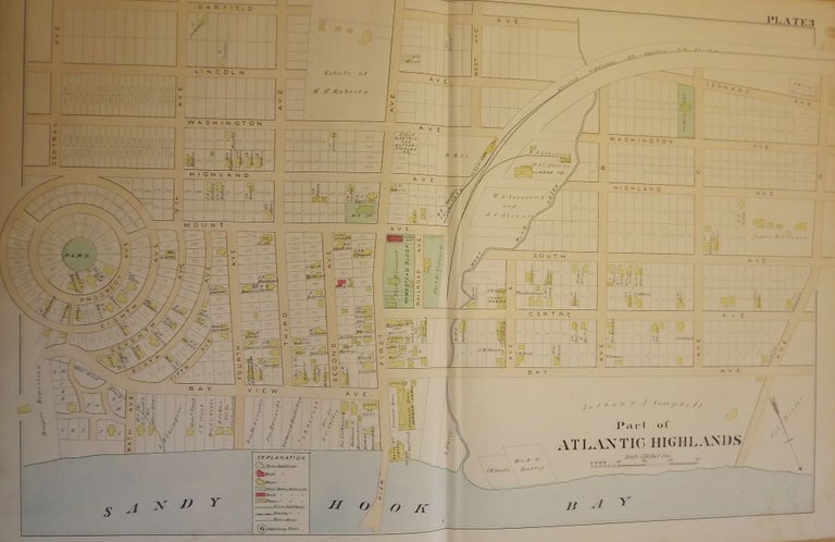
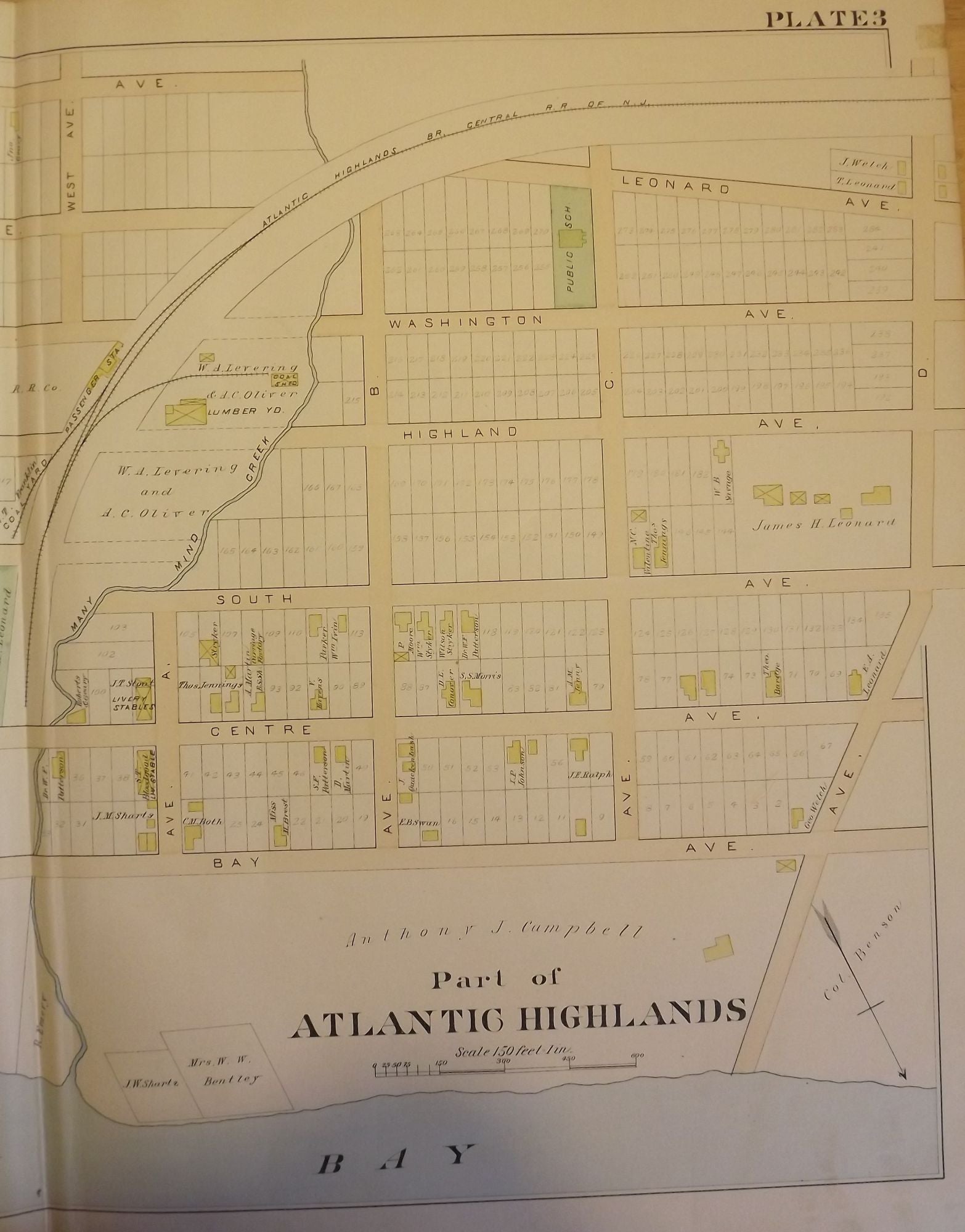
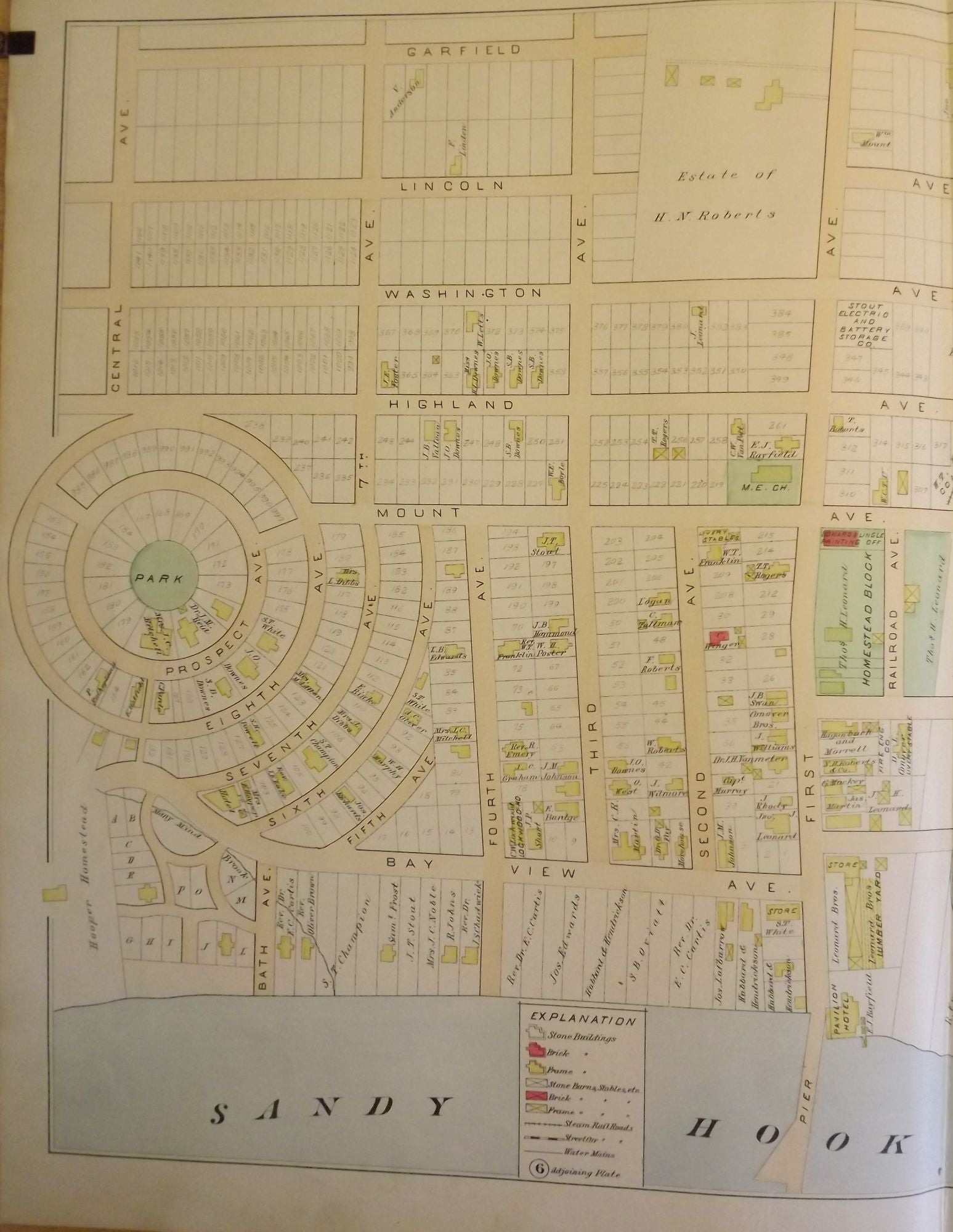
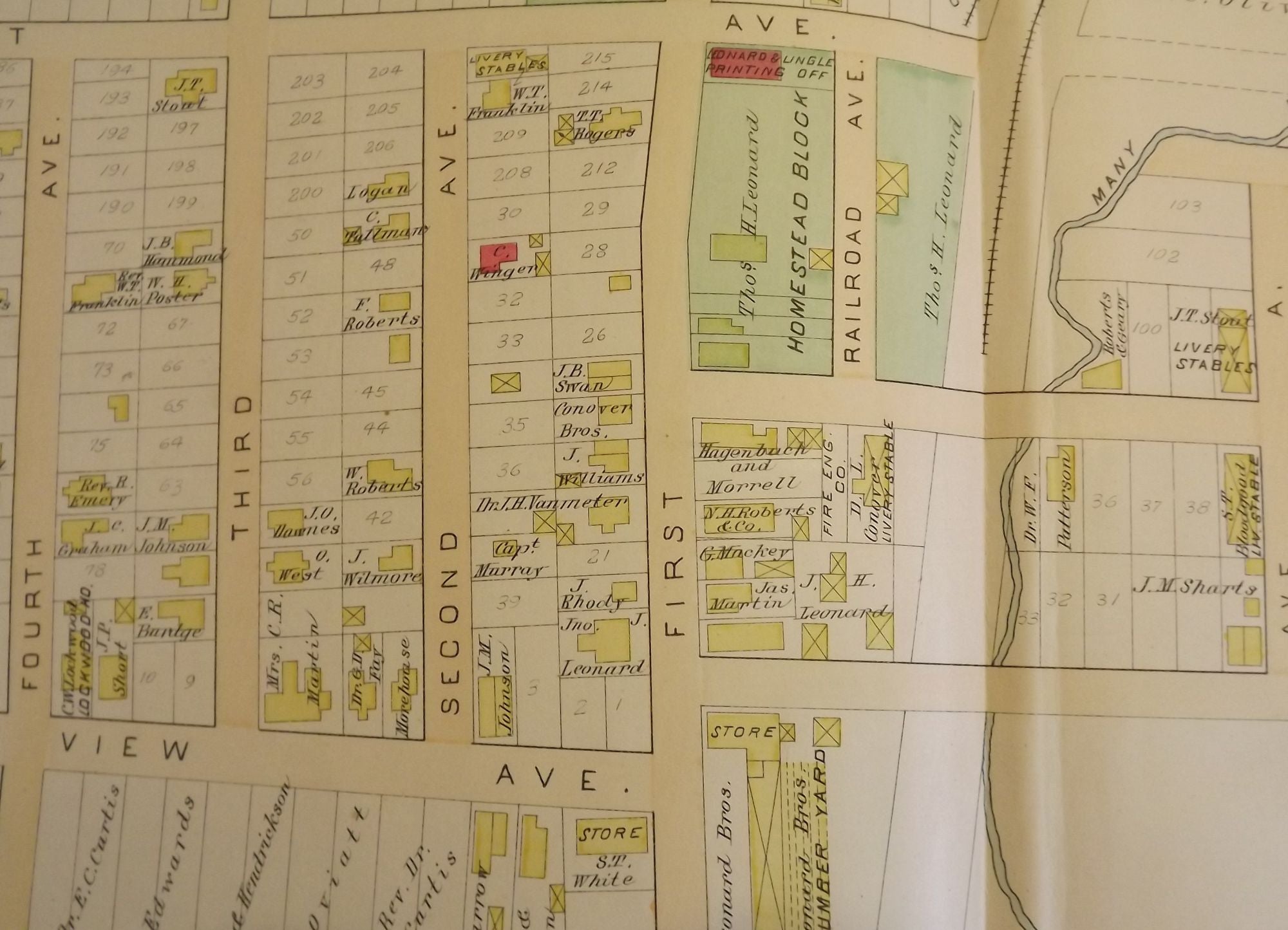
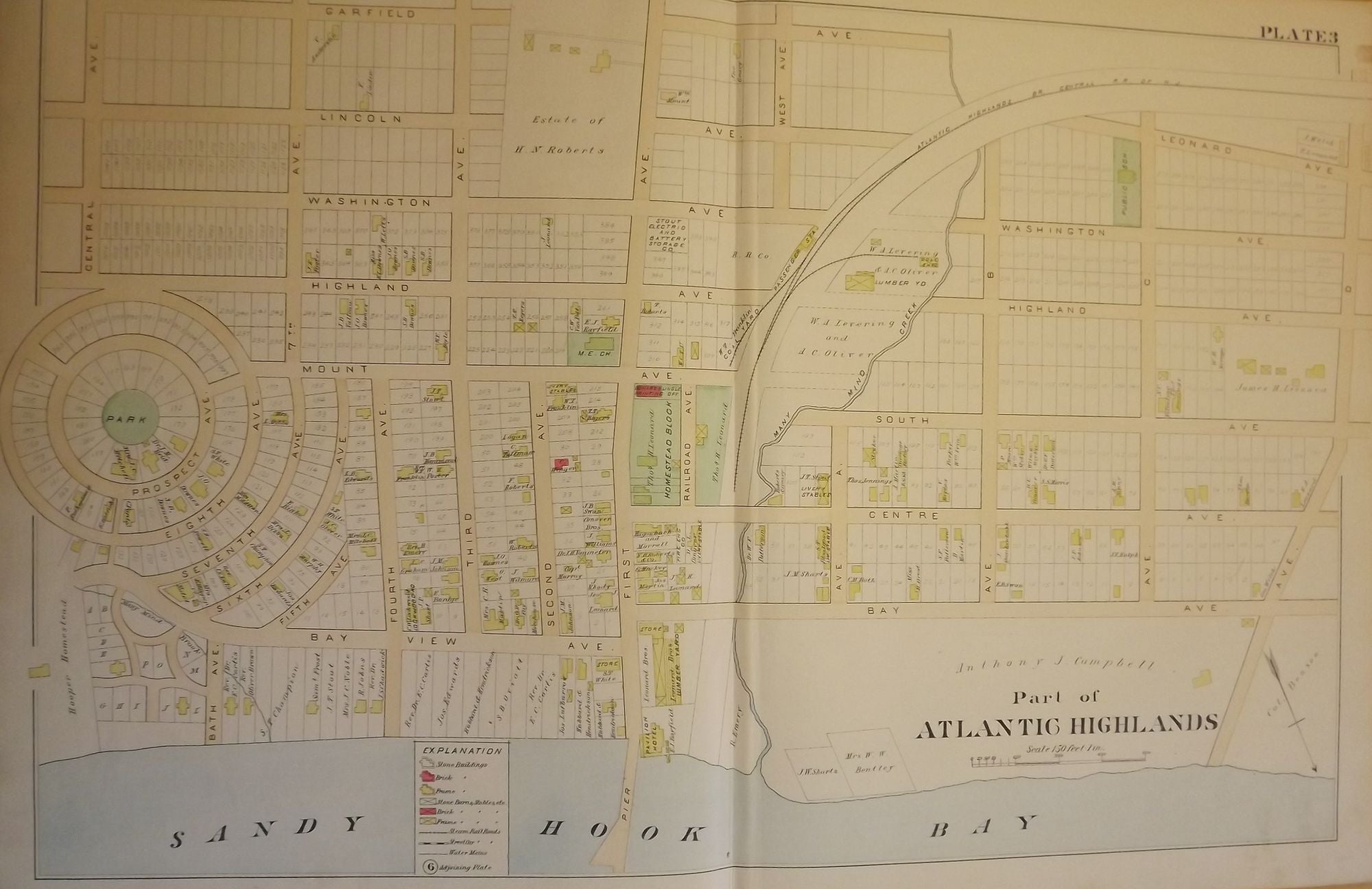
PART OF ATLANTIC HIGHLANDS NJ MAP. FROM WOLVERTON'S ATLAS OF MONMOUTH COUNTY.
NY: Chester Wolverton, 1889. An original 30-inch by 22-inch linen-backed color map published in 1889. Map depicts Part of Atlantic Highlands, from the circular Prospect Park to Avenue D, and from Sandy Hook Bay to Garfield Avenue. Depicts types of structures erected at the time. The original map (Plate 3), not a reproduction! Wolverton maps are among the best you can get of Monmouth County. Item #56905
Very Good.
Price: $150.00
See all items in
NJMAP
See all items by Chester WOLVERTON