

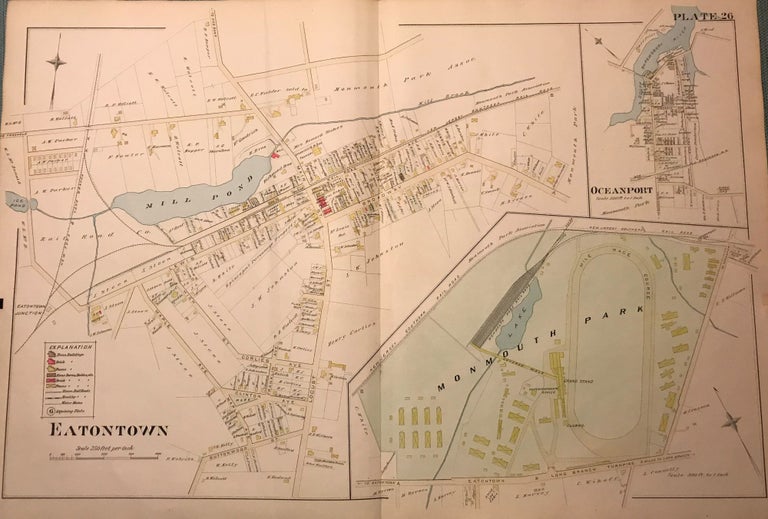
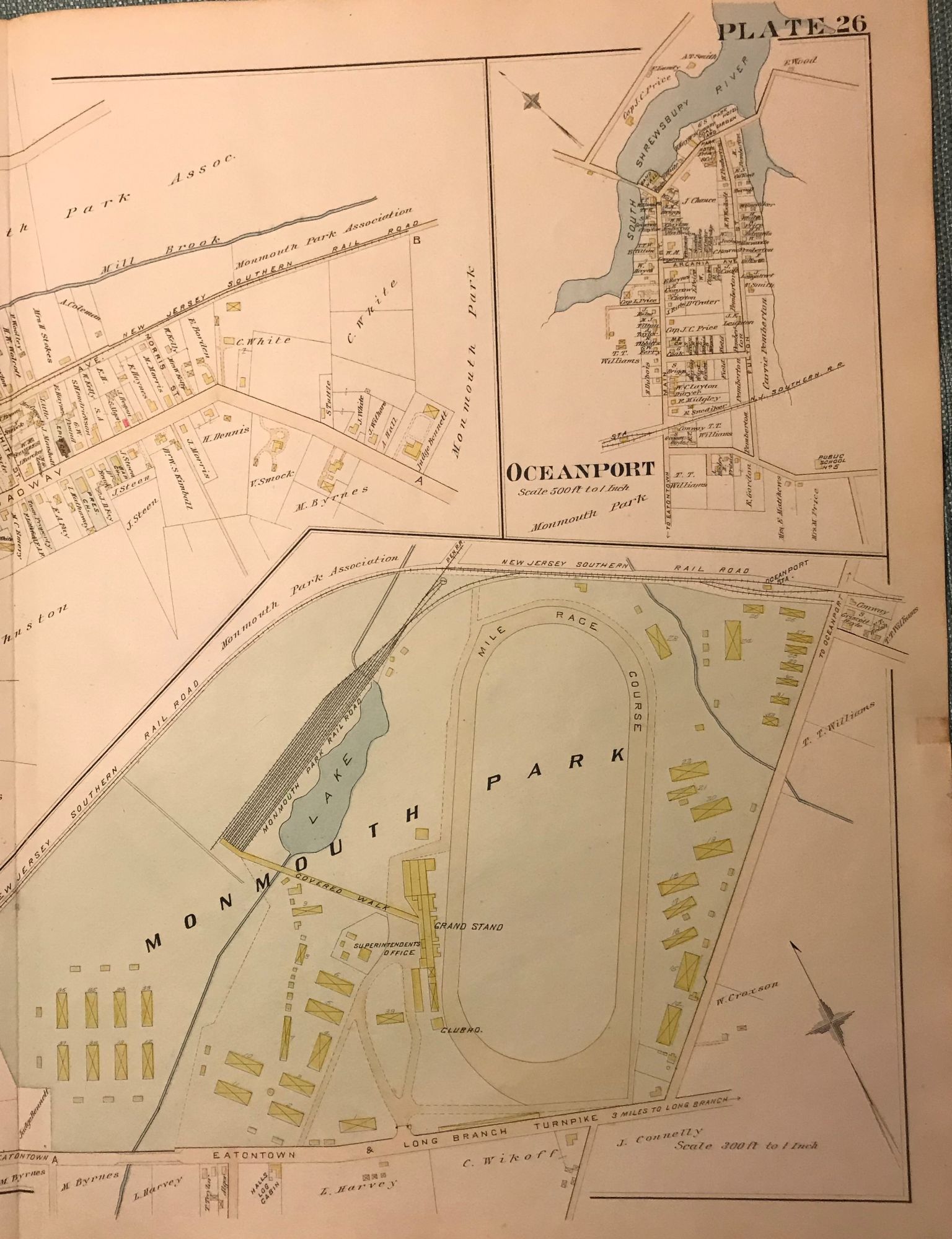
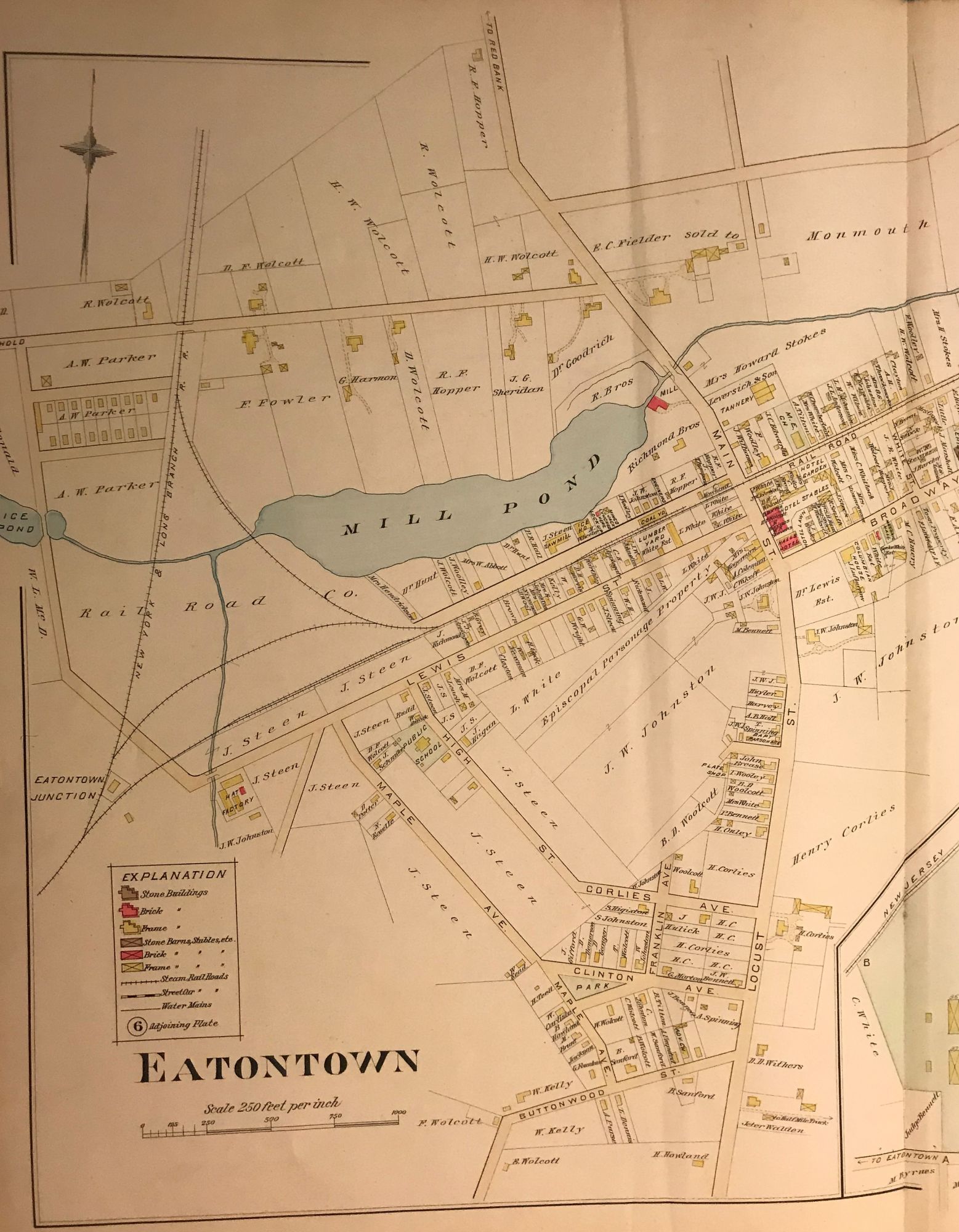
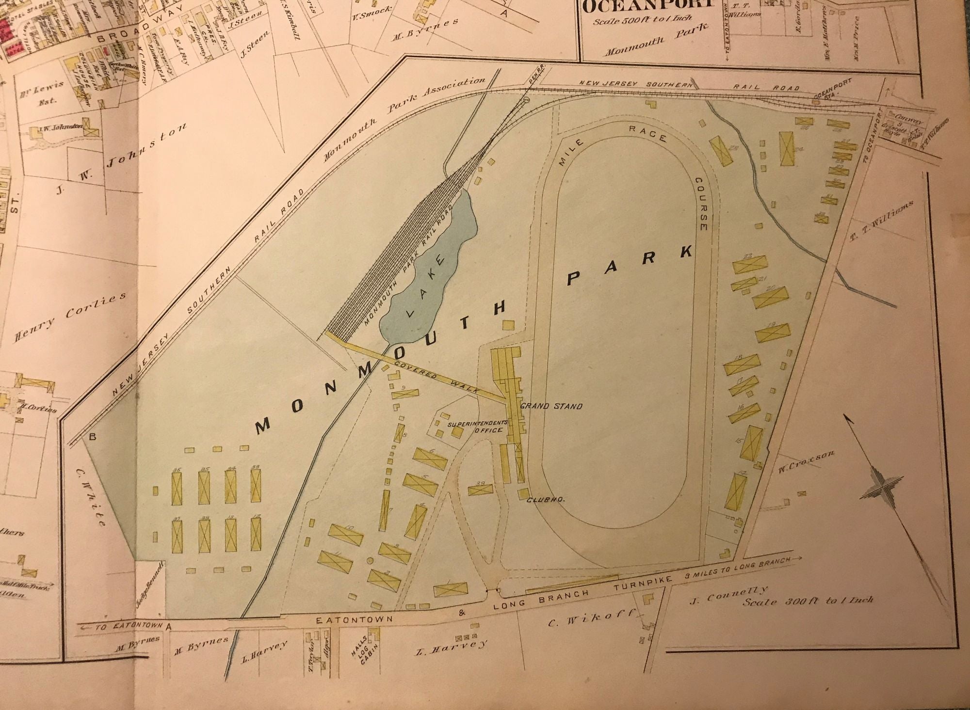
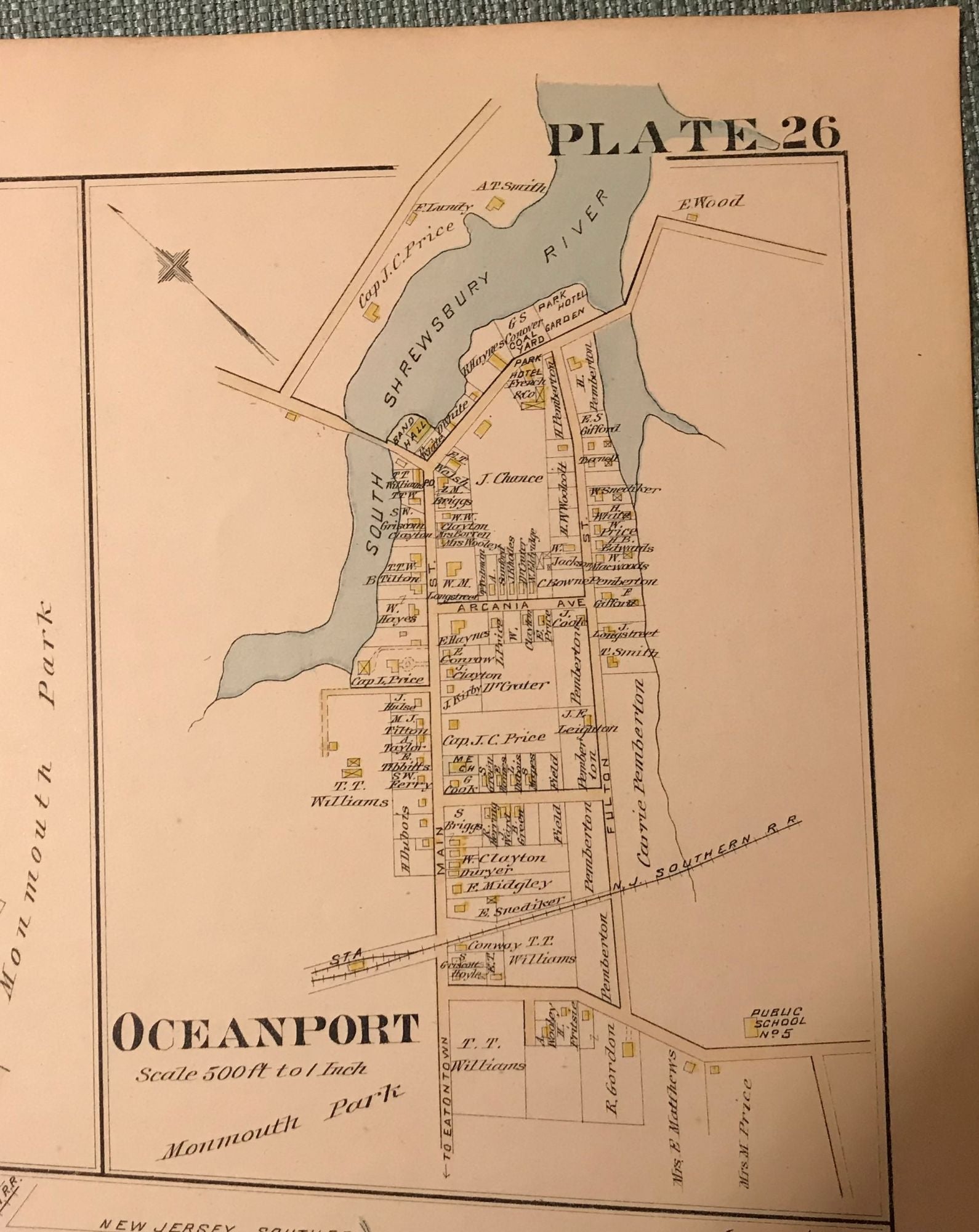
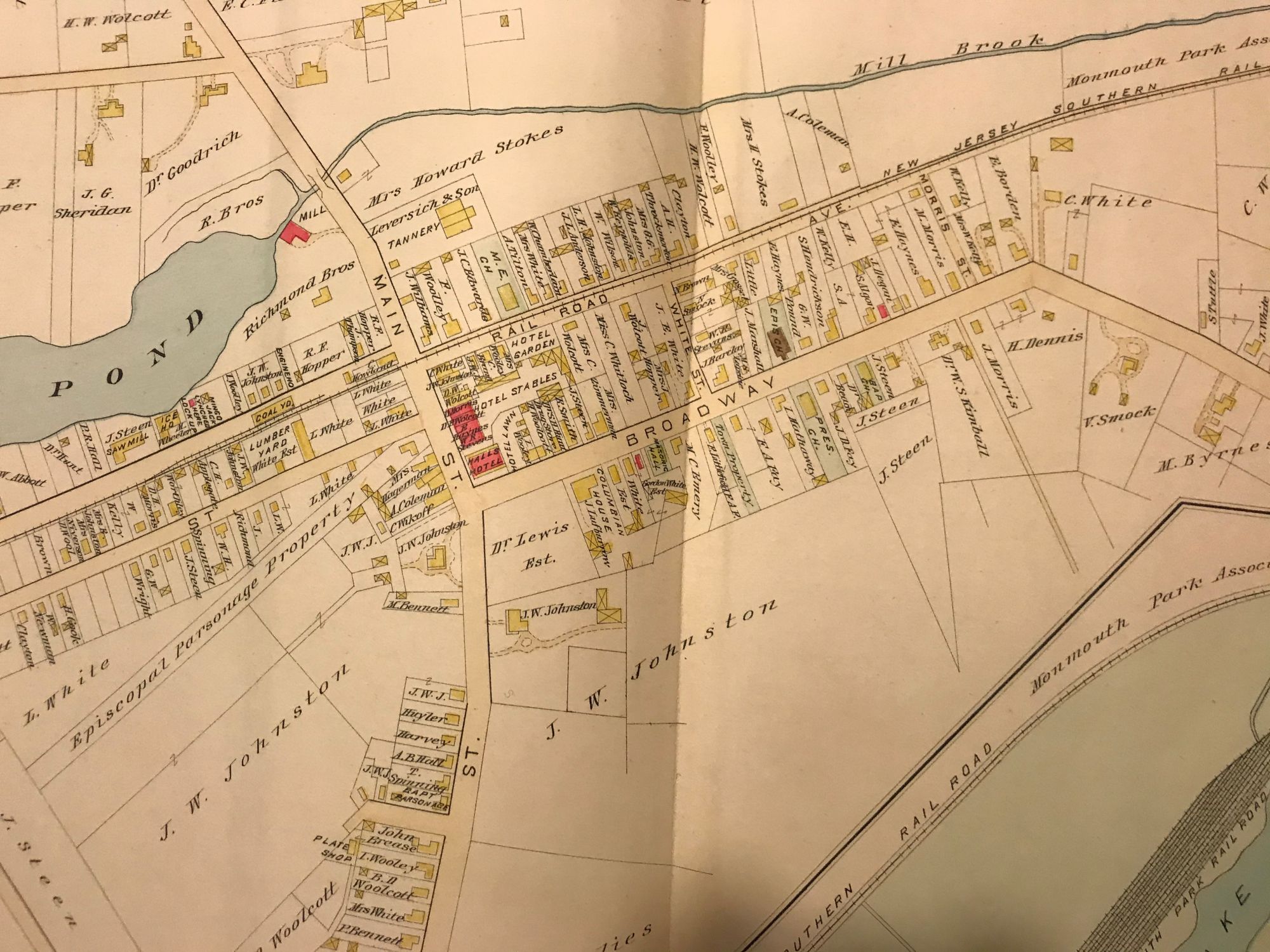
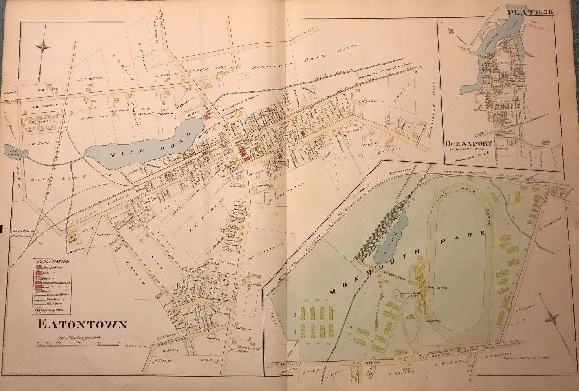
EATONTOWN/ MONMOUTH PARK/ OCEANPORT. NJ MAP. FROM WOLVERTON'S “ATLAS OF MONMOUTH COUNTY,” 1889.
NY: Chester Wolverton, 1889. An original 30-inch by 22-inch linen-backed color map published in 1889. Map depicts Eatontown from the railroad tracks to Monmouth Park; and from the Buttonwood Road area to to the Mill Brook area. Also has insets of Monmouth Park and Oceanport. Shows structures erected at the time. The original hand-colored map (Plate 26), not a reproduction! Wolverton maps are among the best you can get of Monmouth County. Item #57111
Nice condition!
Price: $150.00
See all items in
NJBOOK
See all items by Chester WOLVERTON